
My job as an air traffic controller and my passion for photometeors mean that I’m often asked for an opinion on the so-called “chemtrails”, so I feel the need to clarify things with this writing
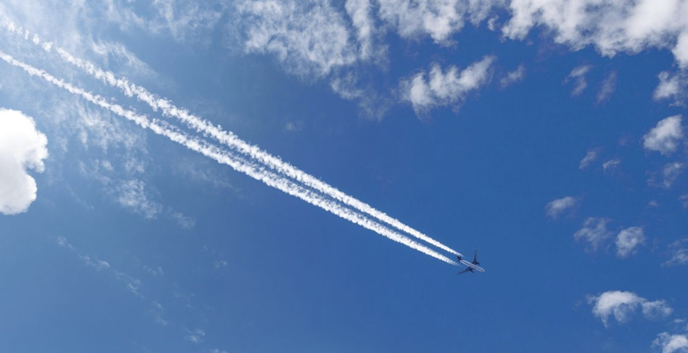
The white streaks that sometimes cross the sky behind aircraft are one of the most easily recognizable atmospheric phenomena linked to air traffic. They are called condensation trails, or contrails (condensation trails), and they form under certain conditions of temperature, pressure, and humidity in the atmosphere.
Their appearance, however, is not always the same. Some vanish quickly, while others can remain visible for a long time, gradually widen, and take on a structure similar to that of cirrus clouds, long and snake-like. In particular lighting conditions, moreover, they can show subtle colorations, giving rise to the optical phenomenon of iridescence.
The topic therefore connects two fields: meteorology, which helps us understand the formation and evolution of the trails, and atmospheric optics, which explains the appearance of the colors.
How a condensation trail forms
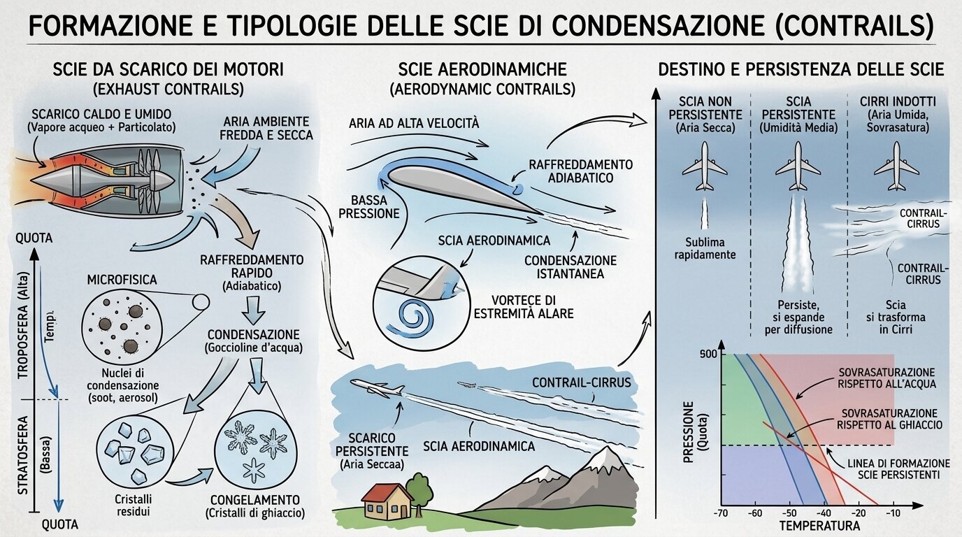
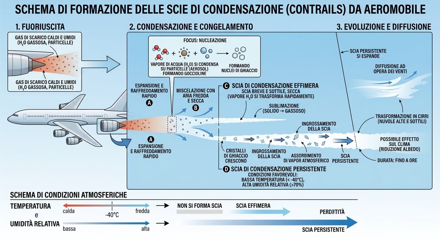
To understand the phenomenon, we must start with the aircraft’s engines. Fuel combustion produces, among other products, water vapor. The exhaust gases are expelled at high temperature and quickly mix with the surrounding air.
At cruising altitudes, generally in the upper troposphere, the atmosphere’s temperature is very low. The conditions for trail formation are closely tied to the balance between temperature, pressure, and humidity, and they typically occur at the altitudes where many flights operate.
When the hot, humid gases from the engines mix with very cold air, the water vapor can quickly reach saturation. The water condenses and, at the sufficiently low temperatures found at altitude, rapidly turns into ice crystals. It is these tiny particles that make the trail visible.
The process therefore has some similarity to cloud formation: in both cases water vapor shifts to a condensed or solid phase through interaction with particles present in the atmosphere. In the case of contrails, however, the initial input of vapor and particles is linked to the aircraft’s exhaust gases.
Why do some contrails vanish and others persist?
The mere formation of a contrail does not necessarily determine its duration.
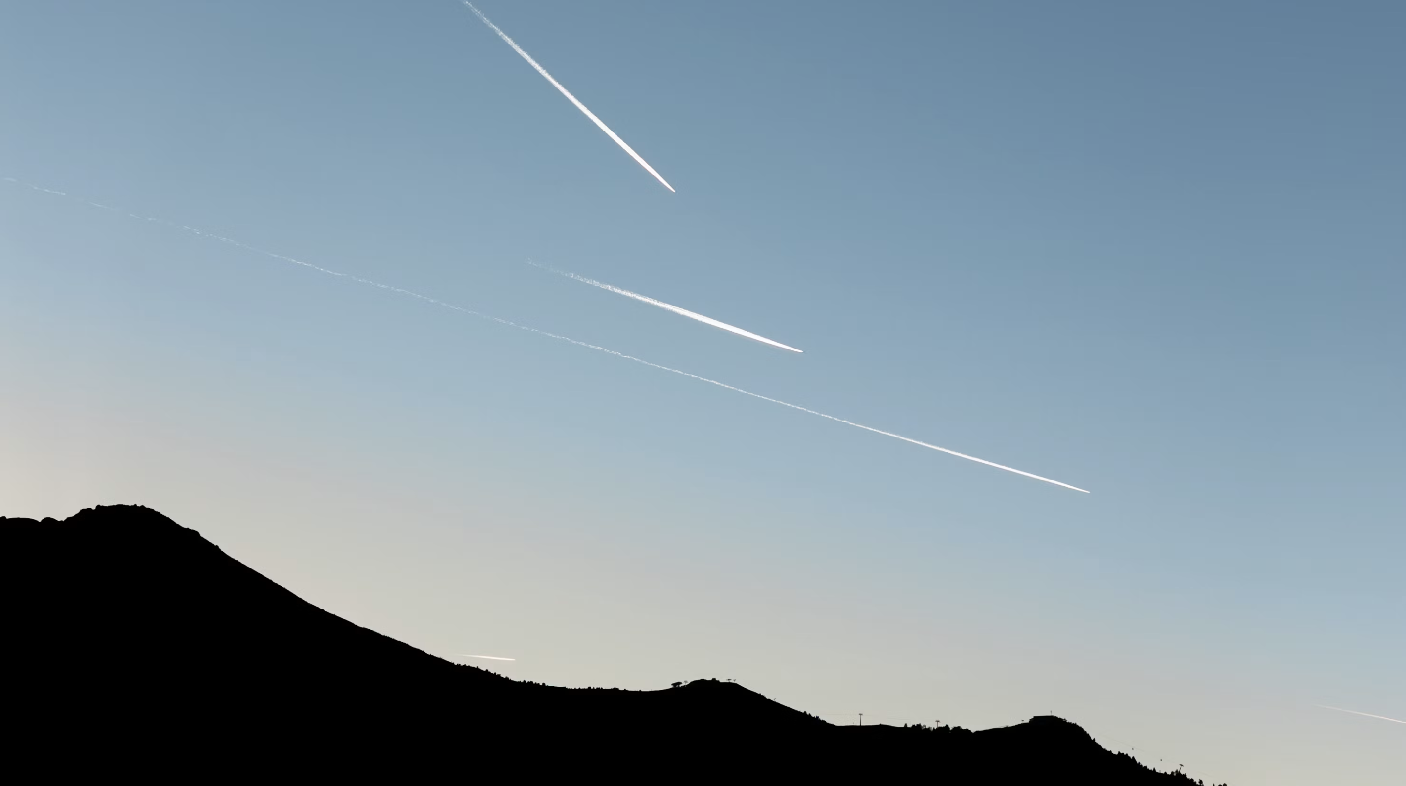
If the surrounding air is relatively dry compared to the ice, the crystals formed behind the aircraft can quickly sublimate and the contrail becomes invisible in a short time. If, on the other hand, the atmospheric environment has sufficiently high humidity, the crystals can persist and the contrail can remain visible for minutes or even much longer. Persistent contrails can also be distorted by winds and turbulence present at high altitudes. Their width increases progressively and the originally thin structure can turn into a much broader cloudy area.
The meteorological classification of clouds also recognizes this evolutionary process: a persistent contrail can be classified as Cirrus homogenitus; if it later changes and takes on features more similar to those of natural clouds, it can be described as a homomutatus cloud. This aspect is important because it shows how a contrail should not necessarily be considered an unchanging structure. It is a dynamic system that continues to interact with the atmospheric environment after the aircraft has passed.
Not all trails have the same origin
It is also useful to distinguish trails generated by exhaust gases from other condensation phenomena associated with aircraft.
Under certain conditions, for example during particular maneuvers or in the presence of high humidity, condensation clouds can form on the wings. The reduction of air pressure over the upper surface of the wing can lead to a drop in temperature; if the atmosphere is sufficiently humid, this can promote the condensation of water vapor.
A similar phenomenon can occur at the wingtips, where the vortices generated by the wing locally produce changes in pressure and temperature. Under favorable conditions, visible condensation may appear.
These phenomena should not be confused with the typical long trail produced by engine exhaust gases.
When a contrail turns iridescent
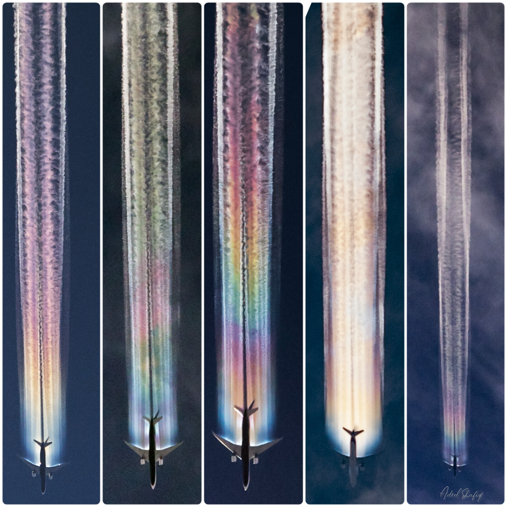
Photo by Adeel Shafiq
One of the most fascinating features that can appear in clouds and contrails is iridescence.
Unlike the rainbow, which mainly comes from refraction, internal reflection and dispersion of light in water droplets, iridescence is linked above all to the diffraction of light by very small particles. The presence of sufficiently small particles with relatively uniform properties can produce a separation of the different colors of light and thus the typical iridescent hues.
The phenomenon can produce delicate, overlapping colors: pink, green, light blue, yellow and violet may appear in sequence or at the same time, often with poorly defined edges.
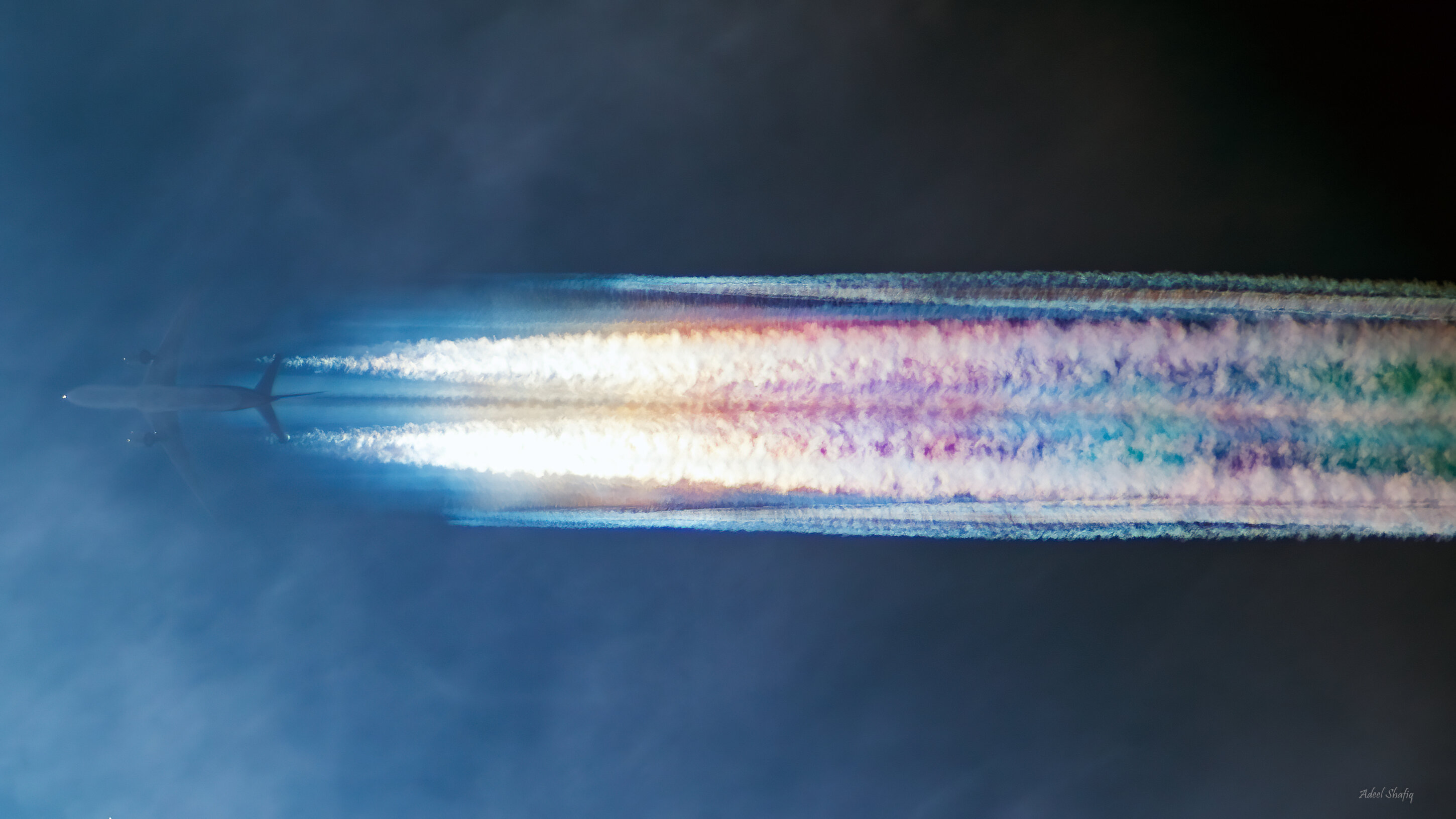
Foto di Adeel Shafiq
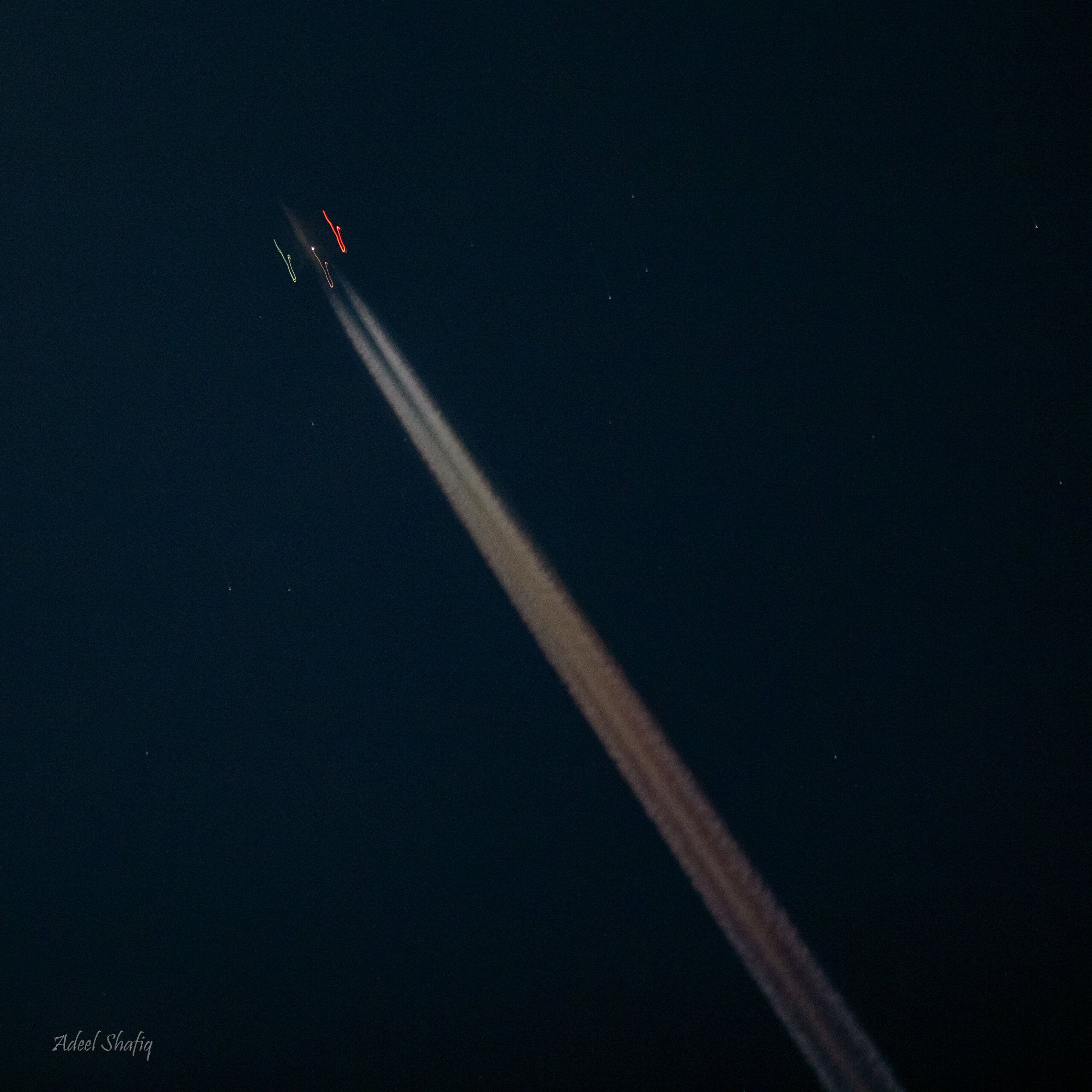
Photo by Adeel Shafiq
Persistent contrails and transformation into clouds
A contrail that lingers in the atmosphere can undergo a notable transformation.
Turbulence and upper-level winds can widen and distort it until it becomes hard to identify as a trace left by a single aircraft. Persistent contrails can gradually turn into broader cloud structures and add to the cloud cover present in the upper troposphere. This evolution also explains why the appearance of a contrail can change radically over a relatively short time: from a thin, well-defined line it can become a wide, wispy band.
Aviation meteorology studies these very conditions to predict where and when contrails may form and what their evolution might be.
Predicting contrail formation
Contrail formation depends on measurable atmospheric variables, in particular temperature, pressure and humidity.
There are tools to predict contrails. Among these, the Appleman diagram is presented, developed to assess the likelihood of contrail formation as a function of atmospheric conditions, and the thermodynamic diagram by Herlofson, also derived from atmospheric radiosonde data.
These tools show how the formation of a contrail is not a random event, but the result of a precise combination of atmospheric characteristics.
Other phenomena associated with aircraft
The interaction between aircraft and clouds can also produce phenomena different from normal condensation trails.
Among these are fallstreak holes, openings that can appear within certain cloud layers when an aircraft’s passage promotes the formation of ice crystals from supercooled droplets.
There are also dissipation trails, or distrails, in which the aircraft’s passage creates an area relatively free of cloud along the flight path.
Condensation trails and the “chemtrail” theory
So-called “chemtrails” (chemtrails) are at the center of a theory according to which the trails left by aircraft would not simply be products of water-vapor condensation, but would instead result from the deliberate release into the atmosphere of chemical substances for undisclosed purposes. This interpretation, however, is distinguished from the meteorological explanation of condensation trails, whose formation is described through well-known physical and chemical processes: the water vapor contained in exhaust gases, encountering the very cold air present at cruising altitudes, can condense and freeze, forming tiny ice crystals. The persistence and spreading of the trail then depend on the atmosphere’s temperature and humidity conditions. Institutional meteorological sources, including the Air Force Meteorological Service, describe these mechanisms without resorting to the hypothesis of a deliberate dispersal of chemical substances. Even the different duration, shape, or apparent coloration of the trails can be explained by atmospheric conditions and by optical phenomena affecting the ice particles. Therefore, in the scientific and meteorological context, the term “chemtrails” does not identify a phenomenon distinct from normal condensation trails, but rather a theory not supported by the available scientific evidence.
Conclusion
A contrail is the result of a relatively simple physical process in its principles, yet extremely variable in its manifestations.
The aircraft’s passage, the characteristics of the exhaust gases and, above all, atmospheric conditions determine the formation of the trail. Temperature and humidity establish whether the newly formed ice crystals will be quickly removed or whether they can persist and develop into a broader cloud structure. When microphysical and geometric conditions are favorable, the same structure can become the stage for a particularly striking optical phenomenon: iridescence. The tiny particles present in the cloud diffract sunlight and can produce the characteristic pastel hues that sometimes accompany contrails or condensation clouds. Observing an iridescent contrail therefore means witnessing two phenomena at the same time: on the one hand, the transformation of water in the atmosphere; on the other, the interaction of light with microscopic particles. It is precisely this combination of meteorology and optics that makes contrails such an interesting phenomenon to observe and study.
Sources
- Italian Air Force Meteorological Service — Contrails: atmospheric physics applied to aeronautical meteorology. Meteo Aeronautica Militare
- Italian Air Force Meteorological Service — Jets, condensation clouds and iridescence. Meteo Aeronautica Militare
- GrAG – Galileo Amateur Astronomers Group — OPOD on iridescent clouds and on atmospheric diffraction phenomena. GrAG
- MeteoAM — classification of special clouds homogenitus and homomutatus. Meteo Aeronautica Militare